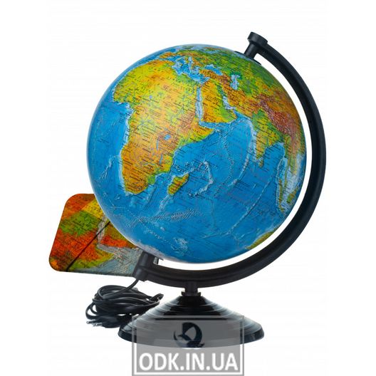
Globe "Physical and political globe with backlight 260 mm (4820114952820)" with double map. When the backlight is off, it is a globe with a physical map of the world: it shows the relief of the land and the seabed, and when the backlight is on, the political map of the world appears: borders and borders, capitals, big cities.
The map of the globe is made in Ukrainian. They are constant helpers in the study of geography.
Can be used as a night light. The globe was created with an agreed classification of symbols, fonts, current geographical names, and the location of settlements corresponds to the coordinates. IPT globes are the only ones in Ukraine that are included in the List of curricula, textbooks and manuals recommended by the Ministry of Education and Science of Ukraine for use in general secondary education. The globes of the Institute of Advanced Technologies are examined every 5 years at the Institute for Modernization of the Content of Education of the Ministry of Education and Science and receive the appropriate stamp of the Ministry of Education and Science.
- diameter 32 cm, table, lacquered;
- backlight - LED;
- stand - plastic;
- meridian - plastic;
- power supply: from the mains 220 V, 50 Hz.